WhatsDown can help you to learn more about MEW
Find Your Location |
Enter address information to zoom to your location of interest |
Learn About MEW Site Details |
Select and de-select mapped features to show boundaries or locations. Select the feature for a description or associated data and reports. |
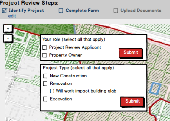
Construction Project Review |
Under Construction - Functionality Coming Soon |
WhatsDownMEW provides publicly available information related to the MEW Site in easily navigable map layers. The maps shows USEPA-defined boundaries, groundwater data, and environmental reports associated with discrete properties. Selecting the map layers turns them on and off. When active, selecting mapped information brings users to additional details about the area boundary, the data, or the reports.
Terradex is pleased to provide WhatsDownMEW for informational purposes. The data presented on the site was gathered from a government sources. While Terradex has taken care to present the data and information accurately, the data and information provided may include inaccuracies and may be incomplete or out of date.
Terradex makes no representations about the suitability of the information contained on this site for any purpose. All information and related graphics are provided "as is" without warranty of any kind. Terradex hereby disclaims all warranties and conditions with regard to this information, including implied warranties and conditions of merchantability, fitness for a particular purpose, title and non-infringement. In no event shall Terradex be liable for the the use, misuse, accuracy of, or otherwise for information or data available from this site.
Location information may not reflect the exact location and should be considered as estimates only. The data and information provided by WhatsDown was gathered over the course of time and data and information is not necessarily up to date. Terradex makes no warranty or guarantee as to the accuracy, timeliness, or completeness of any of the data or information provided, and assumes no legal responsibility for the data or information contained in or depicted on WhatsDown. Any use of WhatsDown with respect to accuracy and precision or otherwise, shall be the sole responsibility of the user.
We welcome comments, suggestions, and contributions related to the accuracy or completeness of the data provided so that we can continue to improve WhatsDown.
Terradex forbids the resale or other commercial use of the information provided in WhatsDown without our express written consent.
Vapor Intrusion Study Area
The Vapor Intrusion Study Area marks the area where USEPA determined, in a 2010-published Record of Decision, that there are potential health risks associated with long-term exposure to trichloroethene (TCE) and other MEW Site chemicals of concern through the vapor intrusion pathway in existing and future buildings overlying the shallow groundwater contamination at the MEW Site.
Within the Vapor Intrusion Study Area, USEPA's 2010-published Record of Decision provided a remedy designed to protect the health of current and future occupants, including workers and residents, of buildings overlying the Site’s shallow subsurface TCE contamination.
EPA’s selected remedy addresses existing buildings and the construction of new buildings., as well as setting future restrictions or requirements, all of which intend to protect against exposure associated with the vapor intrusion pathway.
See EPA's 2010-Published Record of Decision.
Operable Unit 3
[leave blank for now]
USEPA Project Review Area
The Project Permit Review Area is an area defined by USEPA, providing the boundaries inside of which USEPA review may be needed as part of the process of securing City of Mountain View permits for activities such as: excavations, renovate buildings, install utility lines, or engage in similar activities.
This boundary was set by USEPA based on the potential risk due to below-ground contamination that could be exacerbated or otherwise cause adverse impacts in some cases.
Monitoring Wells/Sample Points
Monitoring Wells and additional Sample Points have been sampled in and around the MEW Study Area for the purpose of measuring groundwater quality, and helping to define the boundaries of any chemicals of concern.
Monitoring Wells are permanent wells constructed for the purpose of collecting groundwater samples. All Monitoring Wells shown on WhatsDownMEW collect groundwater samples at depths ranging from approximately 5 to 25 feet below the ground surface.
Sample Points mark areas where "grab samples" have been collected from the shallow groundwater without the use of a Monitoring Well.
Parcel Boundary
Parcel Boundaries, and associated addresses and assessor parcel numbers, depict information made publicly available by the County of Santa Clara. WhatsDown refreshes Parcel Boundary information frequently. See About the Data/Data Dictionary for refresh information.
Building Footprint - Property Specific Environmental Reports
During the environmental response action in this area, environmental studies, collection of data, and or remedial action has occurred at various select properties. Properties marked as having Property-Specific Environmental Reports provide access to environmental-related reports and other information. The available information provides details about sampling results, the environmental and human health risks, if any, at the property and, in some cases, future restrictions on use or future obligations related to use of the property.
| Data | Description | Source of Data | Refresh Date |
|---|
| Vapor Intrusion Study Area | Location polygon depicting area boundary. | USEPA | January 22, 2018 |
| Operable Unit 3 | Location polygon depicting area boundary. | USEPA | January 22, 2018 |
| USEPA Project Review Area | Location polygon depicting area boundary. | USEPA | January 22, 2018 |
| Monitoring Wells/Sample Points Location | Well and Sample Locations | USEPA | January 22, 2018 |
| Monitoring Well/Sample Point Results | Water Quality Data. | USEPA | January 22, 2018 |
| Parcel Boundaries | Map layer and select attributes for property parcels. | County Assessor Public Record | January 22, 2018 |
| Parcel Attributes | Location polygon depicting area boundary. | County Assessor Public Record | January 22, 2018 |
| Building Footprint - Property-Specific Environmental Reports Locations | Location polygon based on address and/or lat and long where property-specific environmental reports impact. | USEPA | January 22, 2018 |
| Environmental Reports | Professional reports addressing environmental conditions at discrete locations. | USEPA | January 22, 2018 |